Seal element of the university of freiburg in the shape of a clover

Research

At the Department for Sensor-based Geoinformatics, our research focuses on leveraging cutting-edge technologies to explore, monitor, and understand the Earth´s biosphere and ecosystems. Through multiple research foci, we strive to advance both scientific discovery and practical applications that help address some pressing environmental challenges of our time:


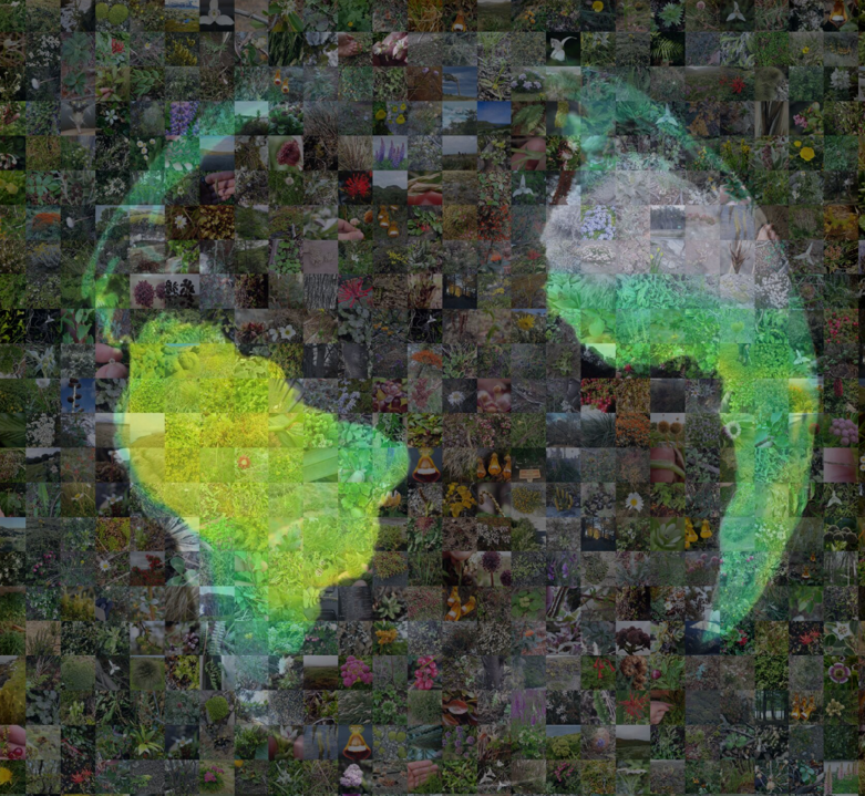
Uncovering Global Patterns of Biodiversity with Citizen Science and Earth Observation
We harness the power of citizen science and earth observation to map and predict global biodiversity patterns. By integrating crowdsourced plant photographs with advanced deep learning models, we aim to fill the gaps in our understanding of plant traits and functional diversity across the globe. This research helps us better understand how biodiversity interacts with environmental factors, contributing to macroecological studies and understanding the behavior of the biosphere in current and future Earth System dynamics.


Revealing Plant and Ecosystem Properties and Functional Processes Across Scales
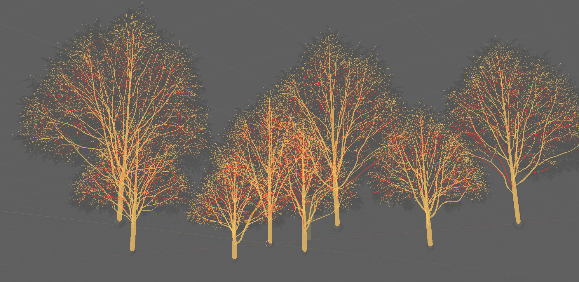
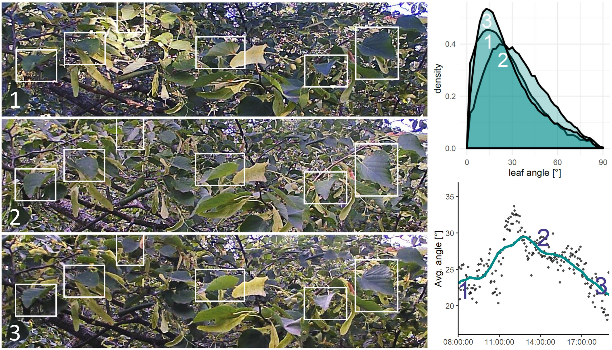
We explore plant and ecosystem properties by utilizing multi-scale analysis, from close-range surveillance cameras, over drones to satellite observations. Our goal is to improve the accuracy of monitoring vegetation physiology, health status, and understanding ecosystem functions. By examining these properties at various scales, we contribute to the understanding of how ecosystems respond to environmental dynamics.


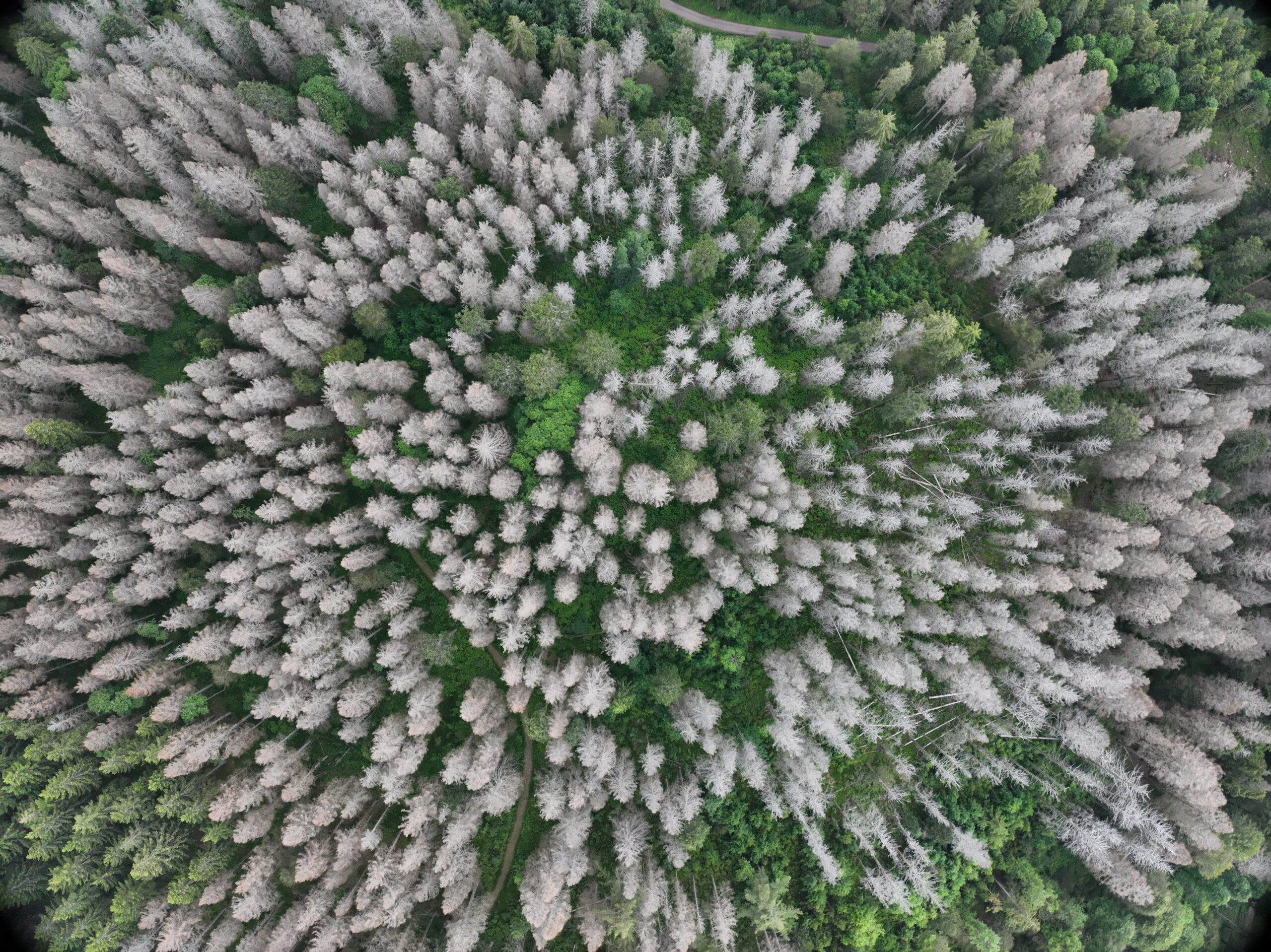
Monitoring and Understanding Global Tree Mortality Dynamics
We are tackling the global issue of rising tree mortality by developing innovative methods to map and analyze deadwood using drones, satellite imagery, and machine learning. Our research creates comprehensive databases that allow us to monitor tree mortality patterns on a global scale, providing crucial geospatial data products to address the impacts of climate change on forests. This work supports vegetation modeling and conservation strategies.


Data Science and Machine Learning Methods to Harness the Potential of Geospatial and Earth Observation Data
The department is at the forefront of developing data science and machine learning methods tailored to the needs of geospatial and earth observation data. By creating tools like WebGIS-based platforms for data curation, georeferenced labeling and AI model training, the department significantly aims to provide state-of-the-art data analytical methods to the community. These advancements are crucial for supporting broader initiatives in earth system science, enabling more sophisticated and scalable analyses of environmental data.

Featured research

Emmy Noether Research Group

PANOPS – Revealing Earth´s plant functional diversity with citizen science

Current knowledge of global patterns of plant traits and functional diversity is limited by geographic, taxonomic, and functional gaps, hindering our understanding of biodiversity and Earth system dynamics. PANOPS aims to fill these gaps by using crowdsourced plant photographs and deep learning to predict and map global plant traits and functional diversity. This approach offers a promising toolset to advance macroecological research and our understanding of biodiversity-environment relationships.

Read more

Collaborative intiative

deadtrees.earth – an open, dynamic database for accessing, contributing, analyzing, and visualizing remote sensing-based tree mortality

deadtrees.earth is addressing the global issue of excessive tree mortality by utilizing drones, crowd-sourcing, Earth observation satellites and machine learning. The initiative overcomes the lack of tree mortality data by developing a dynamic database where users can upload and analyze aerial imagery to detect deadwood. This data is used to train models for large-scale satellite-based mapping of tree mortality. Building on these sensor technologies and data analytical tools, we aim to reveal tree mortality dynamics across the globe.

Read more

Research project

XR Future Forest Lab – virtual reality, augmented reality and mixed reality applications for forest and environmental sciences

This lab will develop cutting-edge virtual, augmented, and mixed reality applications for forest science. This includes advances in data acquisition, analysis, and the creation of digital twins of real forests. These digital twins will allow for the detailed modelling and visualization of forest growth, management processes, and environmental changes across multiple research sites. Thereby, the XR Future Forest Lab will enable simulations of natural changes and human interventions, revolutionizing both research and education in forest science.

Read more

Plant movement from computer vision

AngleCam: Predicting the temporal variation of leaf angle distributions from image series with deep learning

AngleCam, first developed by Kattenborn et al. 2022, is a method for tracking leaf angle dynamics in plants using simple RGB imagery. This data analytical tool provides valuable insights into plant stress and growth patterns by monitoring how leaf angles change over time. AngleCam not only helps researchers understand plant responses to environmental conditions but also explores the impact of these leaf angles on Earth observation data, enhancing our ability to study ecosystems from space. The method is openly available from GitHub and further developed in the project ECOSENSE.

Read more