> Bachelor
Inventuren und angewandte Geomatik
Language: German
When: Winter
No: 10LE07V-761-B.2113
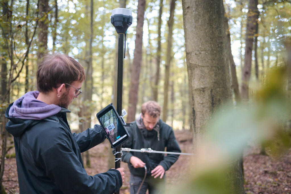
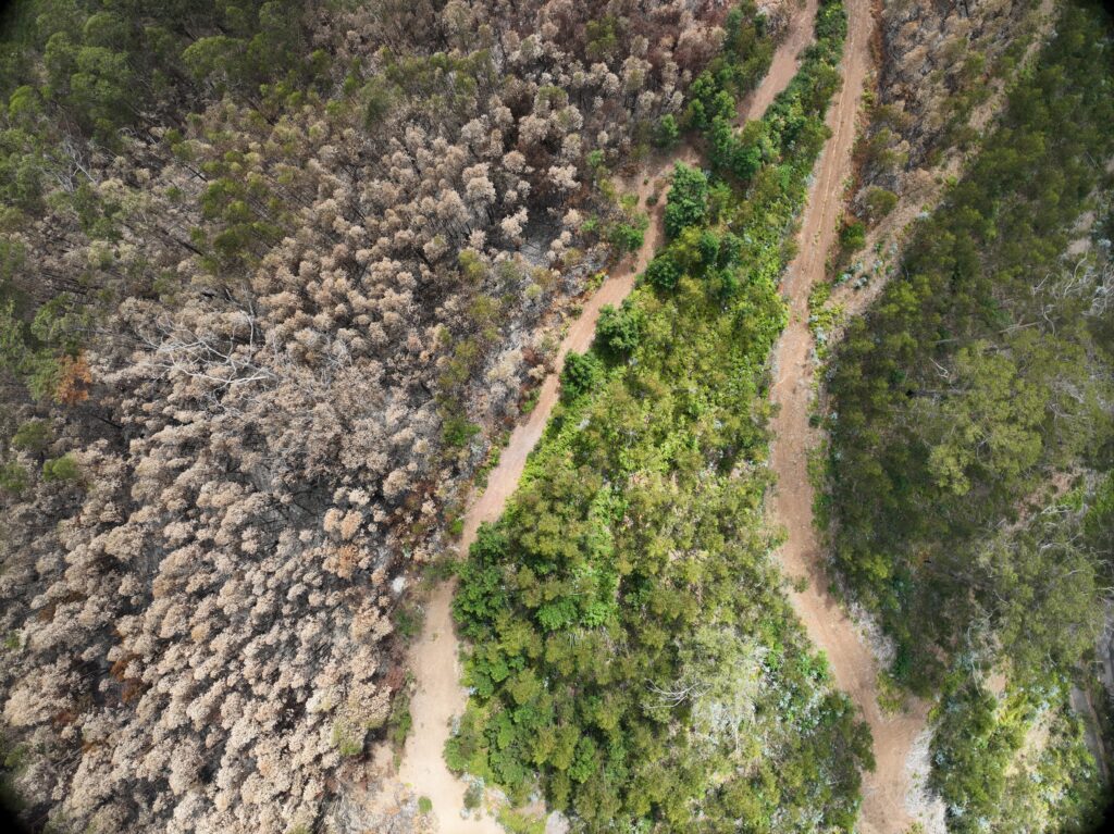
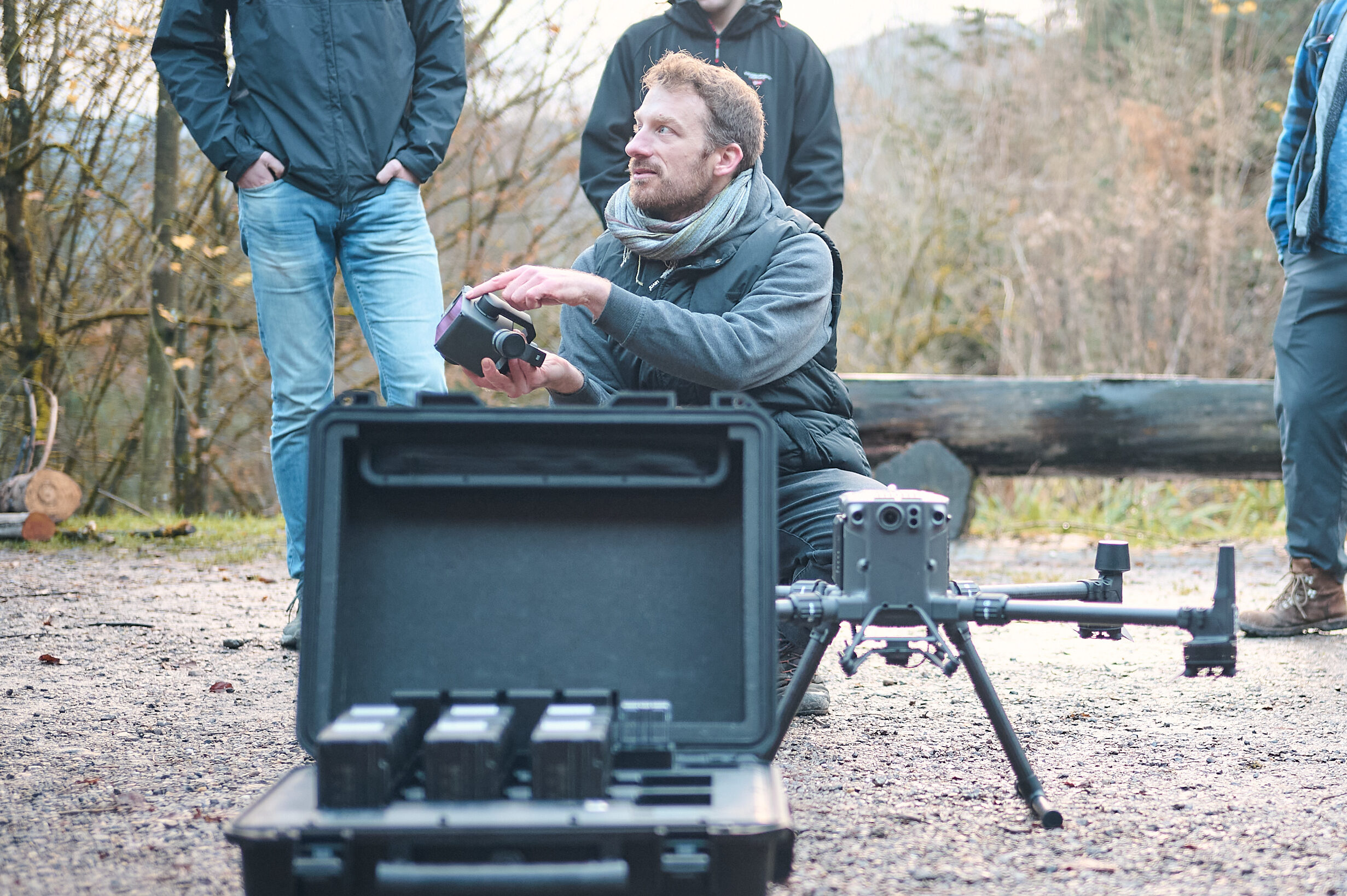
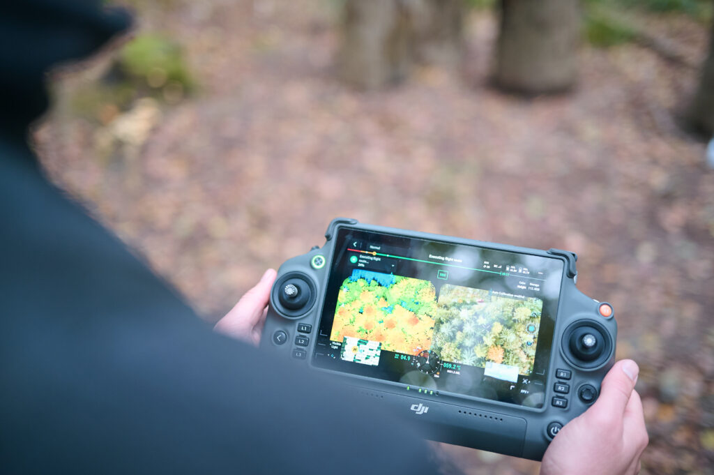
This module aims to provide an overview of current methods in forest inventories. Students will be introduced to field-based methods (measuring tree locations with global navigation satellite systems and collecting tree-related measurements). Based on a complete inventory of a forest stand, we will analyze the effects of sample-based forest inventories (e.g., the influence of sampling method, size, and quality). Additionally, we will compare the accuracy and efficiency of forward-looking methods such as drone-based LiDAR surveys and AI tools for forest inventories. Moreover, students will be introduced to a broad geomatics toolkit and geodata sources that can support large-scale forest assessments (e.g., tree species distribution maps, canopy height maps, and site factors like soil and climate data).
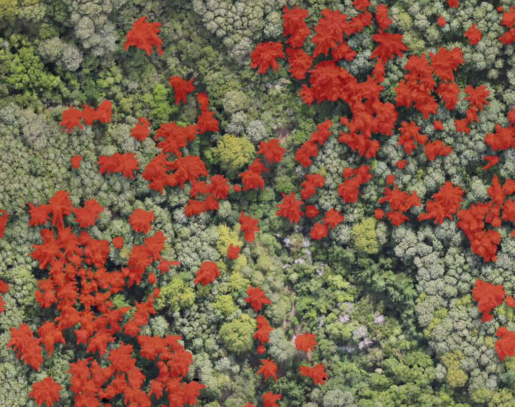
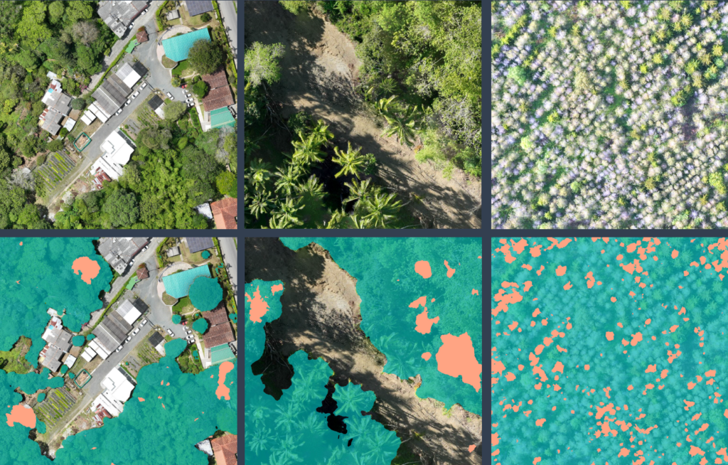
Deadwood Monitoring via Drones, Satellites, and Deep Learning
Language: German
When: Summer
No: 10LE07V-658/761-AllgWPB-3113
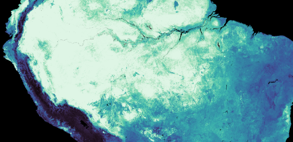
This model will explore the capabilities of multi-scale remote sensing for mapping tree mortality, using deadtrees.earth as a case study. Leveraging drones, satellites, and deep learning, we will assess how different sensors capture tree die-off patterns in the context of climate extremes and accelerating global mortality. Beyond detection, we aim to attribute mortality patterns to environmental dynamics and drivers, integrating climate data, vegetation indices, and spatiotemporal analysis to improve our understanding of forest resilience and vulnerability.
Einführung in die Geomatik
Language: German
When: Summer
No: 10LE07V-B.1107/2108/61296
The module covers fundamental knowledge in cartography, remote sensing, and geospatial data processing. Aerial/Satellite imagery, LiDAR data, and terrestrial sensor data from current research projects are combined, processed, and analyzed. The focus is on the independent application of QGIS. Lectures and interactive exercises alternate regularly, while tutorials provide an opportunity to review the content through guided self-study.
Umweltmonitoring und Geomatik
Language: German
When: Summer
No: 10LE07V-658-B.1117
This module builds on the fundamentals of cartography, remote sensing, and geospatial data processing. In addition to QGIS, the programming language R is used to automate complex spatial analyses and conduct statistical analyses with a spatial reference. Aerial/Satellite imagery, LiDAR data, and terrestrial sensor data from current research projects are combined, processed, and analyzed.
The focus is on independently working with QGIS and R. Research questions from ongoing projects are divided into work packages and systematically addressed. Lectures and interactive exercises alternate regularly, while tutorials provide an opportunity for guided self-study.
Geographische Informationssysteme (GIS)

Language: German
When: Winter
No: 10LE08V-B.GEO.61396
This module builds upon core principles of cartography, remote sensing, and geospatial data processing. Alongside QGIS, the R programming language is employed to automate advanced spatial analyses and perform spatially-referenced statistical evaluations. Students work with real-world data—including aerial and satellite imagery, LiDAR, and terrestrial sensor data—from ongoing research projects.
The emphasis is on developing independent skills in QGIS and R. Research questions drawn from current projects are broken down into structured work packages and systematically explored. The module combines lectures with hands-on exercises, while tutorials support guided self-study.
> Master
Forest Inventory and Information Systems
Language: English
When: Winter
No: 10LE07S-M.22102/22303
This advanced module provides an in-depth exploration of contemporary methods in forest inventories, emphasizing both traditional and cutting-edge approaches. Students will engage with field-based techniques, including precise tree location mapping using global navigation satellite systems (GNSS) and detailed measurements of tree attributes. Building on a complete inventory of a forest stand, we will critically analyze the implications of sample-based forest inventories, focusing on the influence of sampling strategies, sample size, and data quality on forest metrics Moreover, the course will explore the emerging role of technology in forestry. We will evaluate the accuracy, scalability, and cost-effectiveness of forward-looking methods, including drone-based LiDAR surveys and artificial intelligence (AI)-driven tools for automating forest data collection and analysis. Special emphasis will be placed on comparing these methods with traditional techniques to assess their viability for large-scale applications.
Remote Sensing and Geoinformatics
Language: English
When: Summer
No: 10LE07V-M.12308
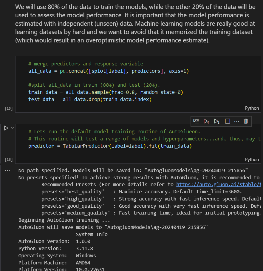
The module will introduce the spectrum of geospatial data for monitoring the terrestrial biosphere. Thereupon, we dive into the analysis of different data types, including drone data for forest health assessments on local scales, Earth observation satellite data for monitoring ecosystem states at large spatial scales and characterization of functional plant traits on global scales using Big-Data from citizen science projects. These contents will tackle state of the art data analytics, such as pattern recognition, dimension reduction and deep learning.
Research Skills
Language: English
When: Winter
No: 10LE07S-M.11102
Lead by the Chair of Biometry, this module will provide students with the essentials of the scientific method, experimental design, data analytics and science communication skills. During this module, students will work on their own their individual projects and thereby gain experience across different research skills. The part of geosense will cover scientific writing, science communication and principles of peer reviewing.
Environmental Monitoring, Data Analysis and Visualization
Language: English
When: Winter
No: 10LE07V-M.12210/12303
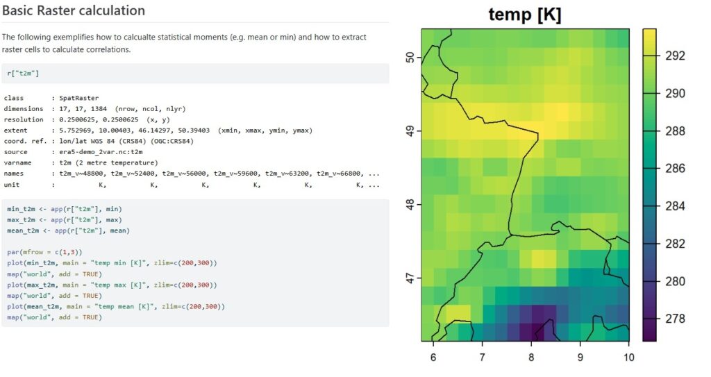
This module provides foundational knowledge for collecting, processing, and preparing time series data with spatial aspects for environmental data analytics. Students conduct an experimental analysis of temperature variability in a research forest area (ECOSENSE site). They collect their own temperature time series and compare them to static sensor installations and climate models. They also learn data visualization techniques in R and GIS,, and gain an introduction to SQL and database systems to store, analyze, and compare data over multiple years.